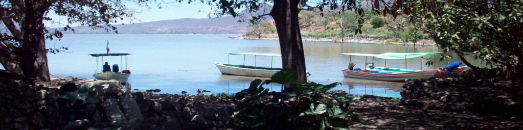
Lake Level
+7
cypress
Trailrunner
ltollefs
MexicoPete
RVGRINGO
slainte39
SunFan
11 posters
Page 2 of 2
Page 2 of 2 • ![]() 1, 2
1, 2
![]()
 Re: Lake Level
![]() by cypress Wed Jul 11, 2018 8:28 pm
by cypress Wed Jul 11, 2018 8:28 pm
ferret I think you are right. That information and the weather sites come from CONAGUA. Now they show that the level has gone up 67 centimeters.
Last edited by cypress on Wed Jul 11, 2018 8:32 pm; edited 1 time in total (Reason for editing : additional information)
cypress- Share Holder

- Posts : 904
Join date : 2012-05-16
![]()
![]()
Re: Lake Level
![]() by cypress Wed Jul 11, 2018 8:42 pm
by cypress Wed Jul 11, 2018 8:42 pm
I knew I had this information somewhere-it just took me awhile to find it; for what it is worth.
The arbitrary level (cota) of 100 .00 was fixed on a bridge at Ocotlan decades ago. The bridge no longer exists, but the cota of 100.00 [elevation 1526.8 meters above mean sea level] has not changed. Owing to various hydrological engineering works, the lake is now considered "full" at cota 97.80. The lake would be "empty" at about 90.00.
-A dimension is the numerical value of any level with respect to another level that has previously been assigned a fixed dimension. In all the world is used like fixed level the one of the sea, whose quota is 0.00m. In order to measure the level of the lake an arbitrary quota established by the Engineer Luis P. Ballesteros in 1910 is taken, taking a fixed point located in the old bridge of the Cuitzeo, on the River Santiago, to the entrance of the population of Ocotlán. At that point he was assigned the quota 100.00, which is equivalent to 1,526.80 meters above sea level (msnm).In 1981, the Secretariat of Hydraulic Resources (SARH) established a new equivalence to the boundary of Ballesteros adjusting it 80 centimeters to be at 1,526 msnm. As a result, the maximum capacity of the lake was established at elevation 97.80 (1,523.80 masl), with a maximum depth of 8 meters and a maximum storage of 7,897 Mm3.
cypress- Share Holder
- Posts : 904
Join date : 2012-05-16
Location : Ajijic
![]()
![]()
Re: Lake Level
![]() by Smartalex Thu Jul 12, 2018 6:33 am
by Smartalex Thu Jul 12, 2018 6:33 am
Ferret: You're right, I see the dates in the heading and also how they relate to the chart. So there is no buoy...just some guy climbing down a ladder to take a reading off a gauge. Not as high tech as what I assumed. Cypress: Thanks for clarifying that.

Smartalex- Share Holder
- Posts : 2678
Join date : 2012-05-14
Location : Chapala
![]()
![]()
Re: Lake Level
![]() by SunFan Thu Jul 12, 2018 9:33 am
by SunFan Thu Jul 12, 2018 9:33 am
My thanks to Cypress for the basis for lake level measurements.
Now does anyone have any information (or speculation) on why the surprising rate of increase compared to previous years? I only go back seven rainy seasons but it doesn't seem like the rainfall this year is that unusually high.
SunFan
Now does anyone have any information (or speculation) on why the surprising rate of increase compared to previous years? I only go back seven rainy seasons but it doesn't seem like the rainfall this year is that unusually high.
SunFan
SunFan- Share Holder
- Posts : 1308
Join date : 2011-09-11
Age : 76
Location : San Antonio Tlayacapan - Upper Chula Vista
Humor : None....no I'm joking.
![]()
![]()
Re: Lake Level
![]() by CanuckBob Thu Jul 12, 2018 9:43 am
by CanuckBob Thu Jul 12, 2018 9:43 am
Well starting last year there is a new agreement requiring the dams to open late June/early July. This explains why the lake has risen earlier than previous years. It feels to me like we have had more rain (so far) than previous years. If you recall it seemed like the rainy season was starting a month early with the days of torrential rains at the beginning of May.
_________________
Vacation Rentals
https://casadecomo.mx/

CanuckBob- Share Holder
- Posts : 20382
Join date : 2010-04-04
Age : 60
Location : Lake Chapala (from Vancouver)
Humor : Sick and twisted -

![]()
![]()
Re: Lake Level
![]() by ferret Thu Jul 12, 2018 10:09 am
by ferret Thu Jul 12, 2018 10:09 am
Also remember that the dams that were newly built had to get filled first. They have now been in place for a number of years so they're letting out water earlier because they better know what's coming in terms of rainfall and refill.
On the subject of rain, I haven't had any today. Just got a call from a friend in El Chante and they've had two inches in the last hour... everywhere is flooded over there... in Joco and in San Juan Cosala. Heads up!
On the subject of rain, I haven't had any today. Just got a call from a friend in El Chante and they've had two inches in the last hour... everywhere is flooded over there... in Joco and in San Juan Cosala. Heads up!

ferret- Share Holder
- Posts : 10234
Join date : 2010-05-23
![]()
![]()
Re: Lake Level
![]() by CanuckBob Thu Jul 12, 2018 12:44 pm
by CanuckBob Thu Jul 12, 2018 12:44 pm

_________________
Vacation Rentals
https://casadecomo.mx/
CanuckBob- Share Holder
- Posts : 20382
Join date : 2010-04-04
Age : 60
Location : Lake Chapala (from Vancouver)
Humor : Sick and twisted -
![]()
![]()
Re: Lake Level
![]() by windrider17 Thu Jul 12, 2018 3:45 pm
by windrider17 Thu Jul 12, 2018 3:45 pm
Raging arroyos in Joco and large lirio islands in Chapala explain a lot.
windrider17- Share Holder
- Posts : 346
Join date : 2013-07-12
Location : Riberas
Humor : Warped
![]()
![]()
Page 2 of 2 • ![]() 1, 2
1, 2
![]()


Page 2 of 2
Permissions in this forum:
You cannot reply to topics in this forum|
|
|